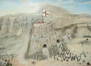
The exact location of the “Round Tower” has been a long-standing mystery – until now. According to the Gibraltar government, ongoing work at the Northern Defences has uncovered evidence that resolves centuries of uncertainty.
The Round Tower was the only part of the fortress to fall to Spanish and French troops the last time hostile forces set foot in Gibraltar. In a press release outlining details of the new discovery, the government recalled that, in the months following the capture of Gibraltar by the combined Anglo-Dutch force in 1704, a series of attempts were made by Spanish and French forces to recapture the fortress, commonly referred to as the 12th Siege of Gibraltar.
As described in detail by Spanish historian Ayala, the closest the Spanish and French got to regaining the fortress was a successful assault on the Round Tower (referred to by the Spanish as El Pastel). This attack was conducted on 7 February 1705 by 300 French Grenadiers supported by Spanish infantry, and the attackers successfully scaled and captured the Round Tower in an assault aimed at exploiting Gibraltar’s most vulnerable northernmost point.
The capture of the tower – located at the end of the King’s Lines – would allow the attackers to bypass the cannons at the Grand Battery that protected the Landport entrance to the fortress. However, their brief occupation of the Round Tower was repulsed after violent fighting, and a subsequent ceasefire allowed 200 men to be buried.

“But where was this Round Tower? Where did so many give their lives to capture and defend our homeland? How close was Gibraltar to falling? It is with hunger for such information, and some clues from written history, that the team at the Northern Defences set off to find the site.”
Several sources referred to its location as being Forbes Battery – at the end of the Queen’s Lines, overlooking the isthmus – and they noted the tower had been destroyed when the latter was constructed. Other sources mentioned that “not even the foundations remain”, so there had been limited interest in the past to find the Round Tower.
Alternative historical sources tell a different story, however, all of which pointed the Northern Defences team to a different conclusion. “It was with this new hope that the team searched for the fallen tower.”
Ayala referred to the crossing of a “foza” (ditch) before the French Grenadiers launched their attack. These details, together with maps provided by professor Jason Dittmer from University College London, allowed the government to have a clear indication of where the tower’s remains, if any, might be. So maps which indicated lines of “communication to the tower” and “path to the old tower site” became the subject of renewed interest.
A rocky outcrop in the Northern Defences that juts out, provides a blind spot to defenders and is located just to the south of the Orilion fault could have been interpreted by Ayala as a “foza”.
This was, therefore, the most obvious place to start searching for a defensive structure that could also act as a lookout. This theory was supported by several historic maps locating the tower there, according to the government.
“It was through sheer determination and hard work that connecting paths were cleared and rubble removed, first exposing a trench and then a section of a battered circular wall. The red mortar, the type of construction and the location provide us with a very good possibility that we have uncovered the area which fell to the enemy in 1705.”
Revealing he had always been excited about the project, deputy chief minister Dr Joseph Garcia commended project director Carl Viagas and the team for their hard work. “Carl has done a magnificent job in sifting through both the written and the physical evidence in order to get to this find. The Northern Defences project is one where I have taken a keen interest, and witnessing the unveiling of such remains, which before I had only read about, is incredibly rewarding.”
Photos courtesy of HM Government of Gibraltar
Click here to learn more about Gibraltar’s fascinating history.


